File:IcemuleAtlasPlate.jpg
Jump to navigation
Jump to search
Size of this preview: 463 × 599 pixels. Other resolution: 1,920 × 2,484 pixels.
Original file (1,920 × 2,484 pixels, file size: 1.97 MB, MIME type: image/jpeg)
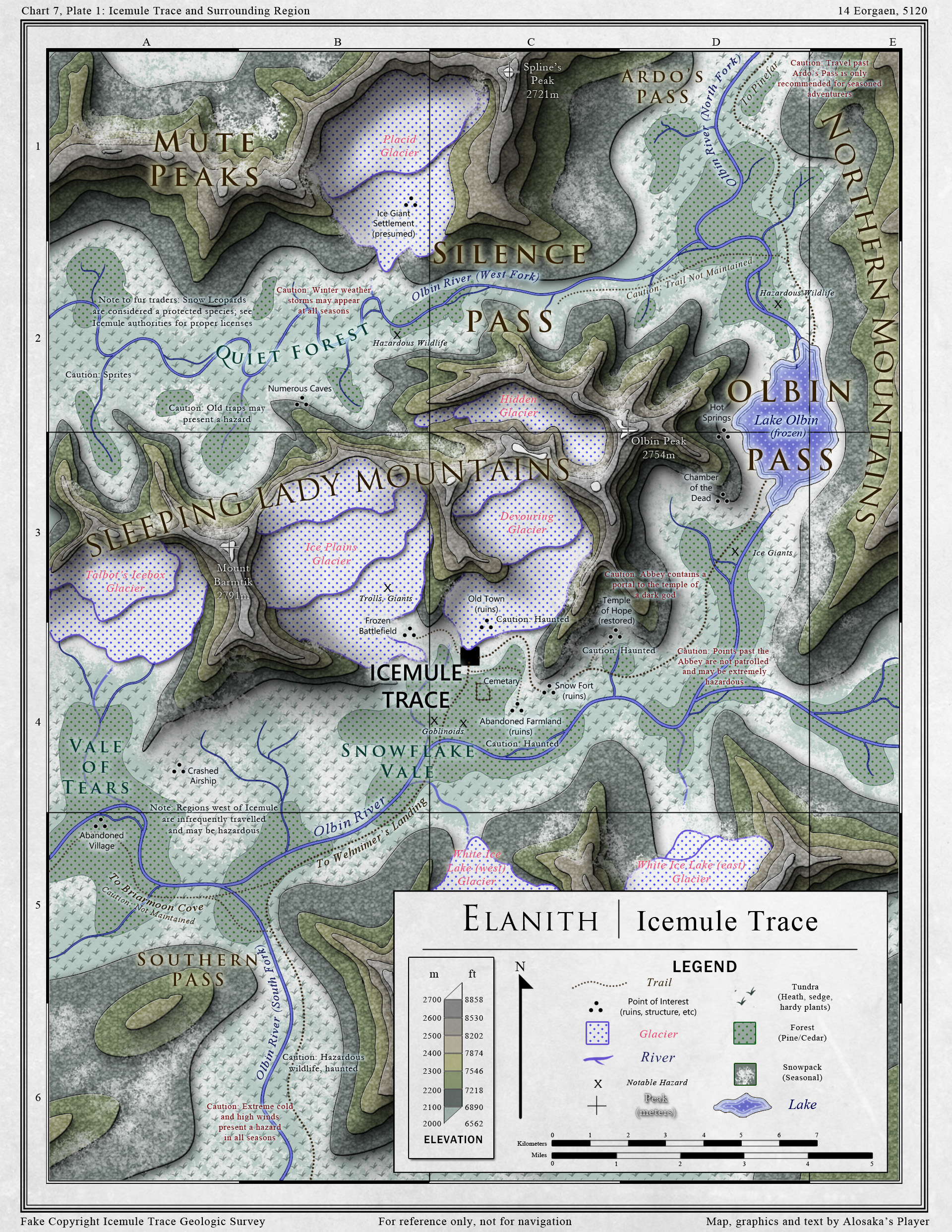
Topographic map of Icemule Trace and the surrounding region, prepared for the Icemule Trace Geological Survey by Alosaka.
File history
Click on a date/time to view the file as it appeared at that time.
| Date/Time | Thumbnail | Dimensions | User | Comment | |
|---|---|---|---|---|---|
| current | 21:55, 25 February 2022 | | 1,920 × 2,484 (1.97 MB) | JSEVERNS (talk | contribs) | Topographic map of Icemule Trace and the surrounding region, prepared for the Icemule Trace Geological Survey by Alosaka. |
You cannot overwrite this file.
File usage
The following page uses this file: