File:Map LDI invasion map 1.png
Jump to navigation
Jump to search
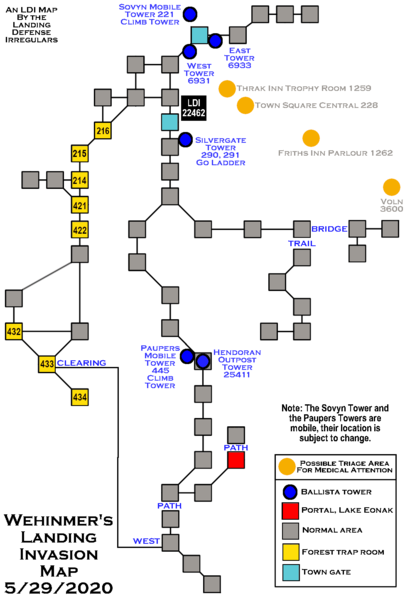
Size of this preview: 405 × 599 pixels. Other resolution: 975 × 1,443 pixels.
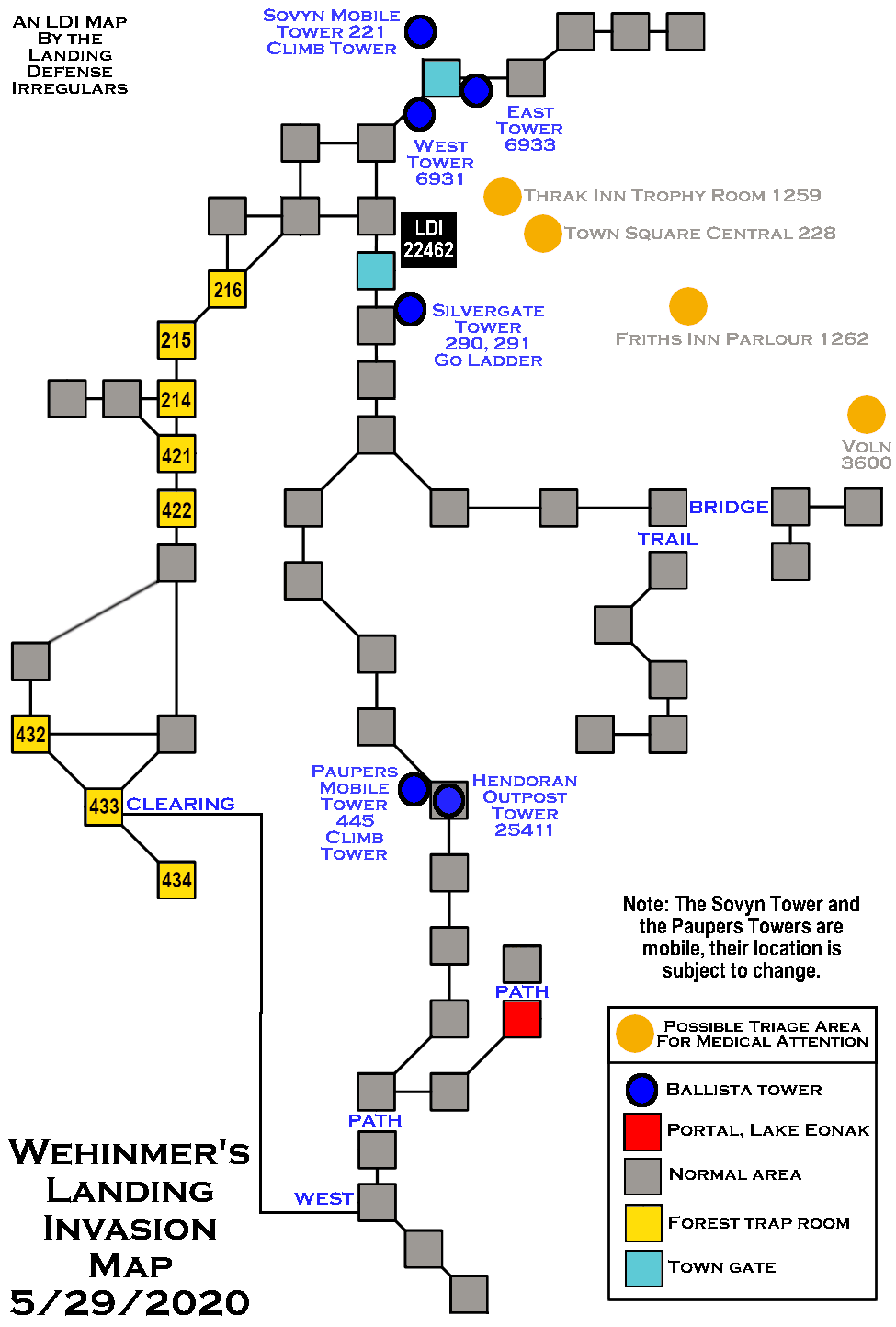
Original file (975 × 1,443 pixels, file size: 37 KB, MIME type: image/png)
This is just a map i made that shows where forest log traps can be set in the Lower Dragonsclaw forest near Wehnimer's Landing, which does not ever change. It also includes the location of the main town defense towers including a couple of mobile towers for Sovyn and Paupers whose location does often change. It also shows the Hendoran Outpost. It indicates a few of the triage areas. It is not the best map but I hope it is helpful. I will upload new versions as I note mobile towers moving around and if I have time.
File history
Click on a date/time to view the file as it appeared at that time.
| Date/Time | Thumbnail | Dimensions | User | Comment | |
|---|---|---|---|---|---|
| current | 21:19, 3 July 2020 | | 975 × 1,443 (37 KB) | FIRENSIA (talk | contribs) | This is just a map i made that shows where forest log traps can be set in the Lower Dragonsclaw forest near Wehnimer's Landing, which does not ever change. It also includes the location of the main town defense towers including a couple of mobile tower... |
You cannot overwrite this file.
File usage
The following page uses this file: