File:Frostacres.gif: Difference between revisions
Jump to navigation
Jump to search
(This map is actually of the Four Winds Isle area, which was historically known as Frostacres. This map was made by Tsoran and was downloaded from his site [http://www.tsoran.com] on Dec 12, 2006. Category:Tsoran Maps) |
(TSORAN uploaded a new version of File:Frostacres.gif) |
||
| (3 intermediate revisions by 2 users not shown) | |||
| Line 1: | Line 1: | ||
This map is actually of the Four Winds Isle area, which was historically known as Frostacres. |
This map is actually of the Four Winds Isle area, which was historically known as Frostacres. A newer version is available [[:Image:FWI.png|here]]. |
||
This map was made by Tsoran |
This map was made by Tsoran. |
||
[[Category:Tsoran Maps]] |
|||
Latest revision as of 16:21, 11 September 2017
This map is actually of the Four Winds Isle area, which was historically known as Frostacres. A newer version is available here.
This map was made by Tsoran.
File history
Click on a date/time to view the file as it appeared at that time.
| Date/Time | Thumbnail | Dimensions | User | Comment | |
|---|---|---|---|---|---|
| current | 16:21, 11 September 2017 | 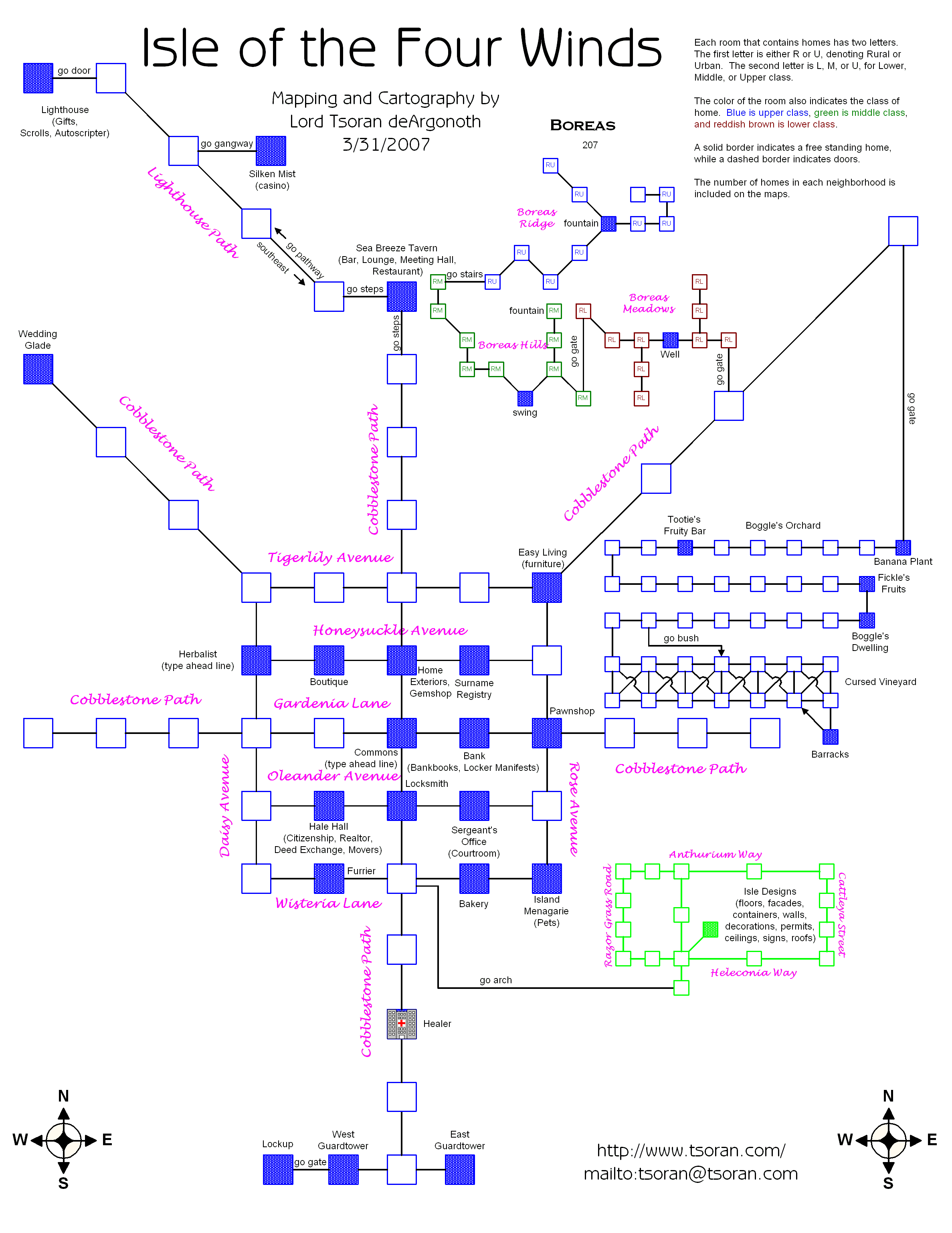 | 2,375 × 3,076 (178 KB) | TSORAN (talk | contribs) | Added premium homes exteriors shop |
| 15:56, 31 December 2014 |  | 2,364 × 3,060 (178 KB) | GS4-KEIOS (talk | contribs) |
You cannot overwrite this file.
File usage
The following page uses this file: