File:Map LDI barracks 1.gif
Jump to navigation
Jump to search

Size of this preview: 587 × 600 pixels. Other resolution: 593 × 606 pixels.
Original file (593 × 606 pixels, file size: 57 KB, MIME type: image/gif, 0.1 s)
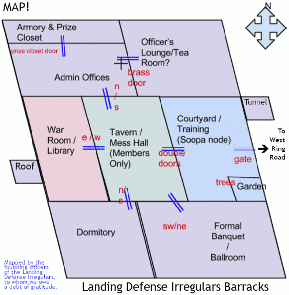
This is a map of the Landing Defense Irregulars (LDI) Barracks, an MHO structure located on West Ring Road in Wehnimer's Landing, three west from Town Square Central. The map was originally created by the founding officers. We continue to use it to this day, and are posting the map here with their permission, so that we may add the map to the LDI gswiki page.
File history
Click on a date/time to view the file as it appeared at that time.
| Date/Time | Thumbnail | Dimensions | User | Comment | |
|---|---|---|---|---|---|
| current | 13:59, 27 May 2020 | | 593 × 606 (57 KB) | FIRENSIA (talk | contribs) | This is a map of the Landing Defense Irregulars (LDI) Barracks, an MHO structure located on West Ring Road in Wehnimer's Landing, three west from Town Square Central. The map was originally created by the founding officers. We continue to use it to thi... |
You cannot overwrite this file.
File usage
The following page uses this file: