File:Brisker's Cove map.png: Difference between revisions
Jump to navigation
Jump to search
(A map of the currently accessible areas of Brisker's Cove.) |
(No difference)
|
Latest revision as of 09:26, 12 June 2023
A map of the currently accessible areas of Brisker's Cove.
File history
Click on a date/time to view the file as it appeared at that time.
| Date/Time | Thumbnail | Dimensions | User | Comment | |
|---|---|---|---|---|---|
| current | 09:26, 12 June 2023 | 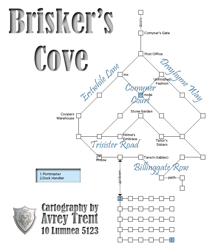 | 704 × 804 (110 KB) | AYAKI1 (talk | contribs) | A map of the currently accessible areas of Brisker's Cove. |
You cannot overwrite this file.
File usage
The following 2 pages use this file: